Freshwater
In-flows and out-flows
Before the artificial entrance was cut in 1889 river floods built up the level of the lakes until water spilled out across a low-lying section of the outer barrier. In dry weather low river flow and high evaporation lowered the lake level and the outlet would become sealed by sand deposition.
Spring tidal range at Lakes Entrance is about a metre, but tidal movements are not transmitted far into the lakes. Tidal influence at Metung for example is only about 10cm. The further west into the lakes system you go, the greater the water height is influenced by weather conditions rather than by tides.
After heavy rain and river flooding the level of the lakes rises and water pours out of the entrance, even against the incoming tide.
Salt loads in the Lakes
Salinity conditions in the lakes are largely determined by the fresh water from rain and rivers flowing into the lakes and salt water flowing in from the sea.
Salinity at the surface of the lake is generally less than salinity at depth, particularly in calm weather.
In summer and autumn, when evaporation is high and fresh water input from rain and rivers reduced, the salinity of the Lakes increases. In winter when evaporation is low and rainfall higher the increasing river flow decreases the salinity of the Lakes.
The salinity of the Lakes has a big influence on the plants and animals that live in and around the lakes.
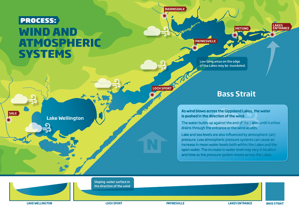
Wind and atmospheric systems
As wind blows across the Gippsland Lakes, the water is pushed in the direction of the wind. The water builds up against the end of the lakes until it either drains through the entrance or the wind abates.
Lake and sea levels are also inuenced by atmospheric (air) pressure. Low atmospheric pressure systems can cause an increase in mean water levels both within the lakes and the open water. The increase in water level may vary in location and time as the pressure system moves across the lakes.